

Red Rock Trail System
BIRMINGHAM, AL
The Red Rock Trail System (RRTS) is a network of trails, parks, bike lanes, and sidewalks in Jefferson County, Alabama. The trail system is made up of seven major corridors spanning Jefferson County. Each corridor consists of different types of trails that connect the county together. The main trails primarily follow the Birmingham area waterways. As of May 2023, 129 miles of trails have been completed. The Freshwater Land Trust (FLT) is constantly working with government, business, and community groups to complete more trails.
Collaborators
ArchitectureWorks
– Cindy Coyle
– Carlos Hernandez
Freshwater Land Trust
- Carolyn Buck
– Rusha Smith
– Sally Sperling
Recognition
- Creative Quarterly 71, Runner Up
- 2022 American Graphic Design Award

It was revealed through interviews with FLT staff and their board of directors that a priority of the new identity system would be to communicate that the Red Rock Trail System was part of FLT. The design solution was to use the existing FLT logo enclosed within a typographic diamond that inextricably linked the two entities.

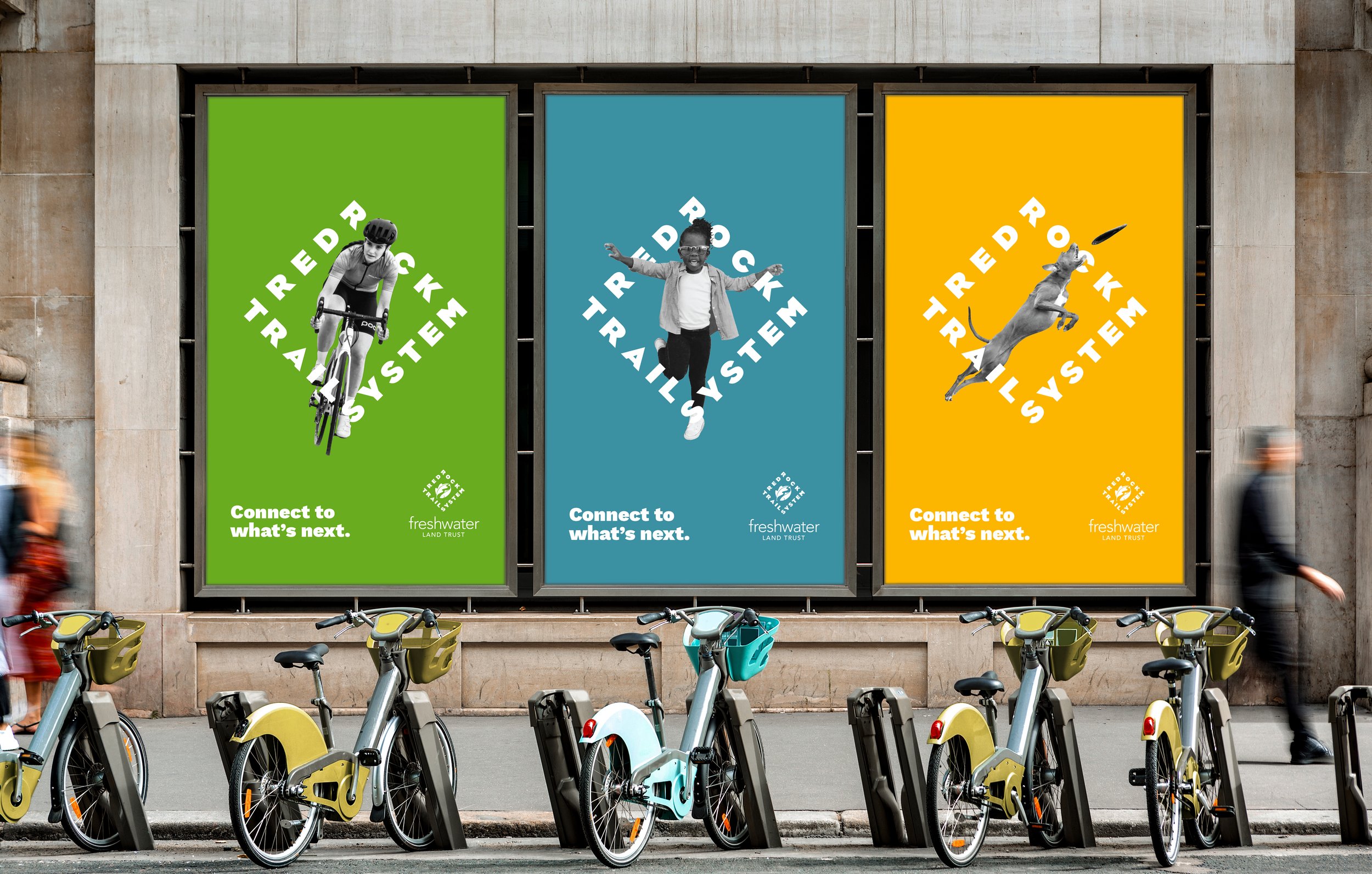
One of the key terms used to describe RRTS that came up in every client meeting and discussion with the board of directors was the word connections. This inspired the RRTS brand motto, “Connect to what’s next.” The phrase becomes a opened-ended motto that gives the audience the opportunity to define how they use the trail system.
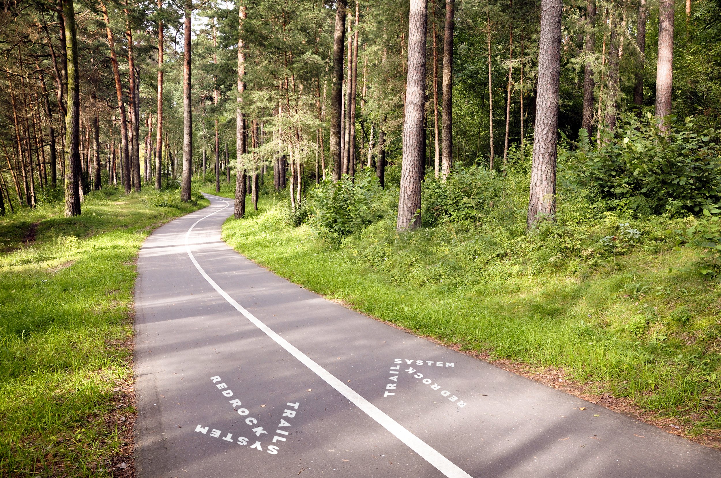
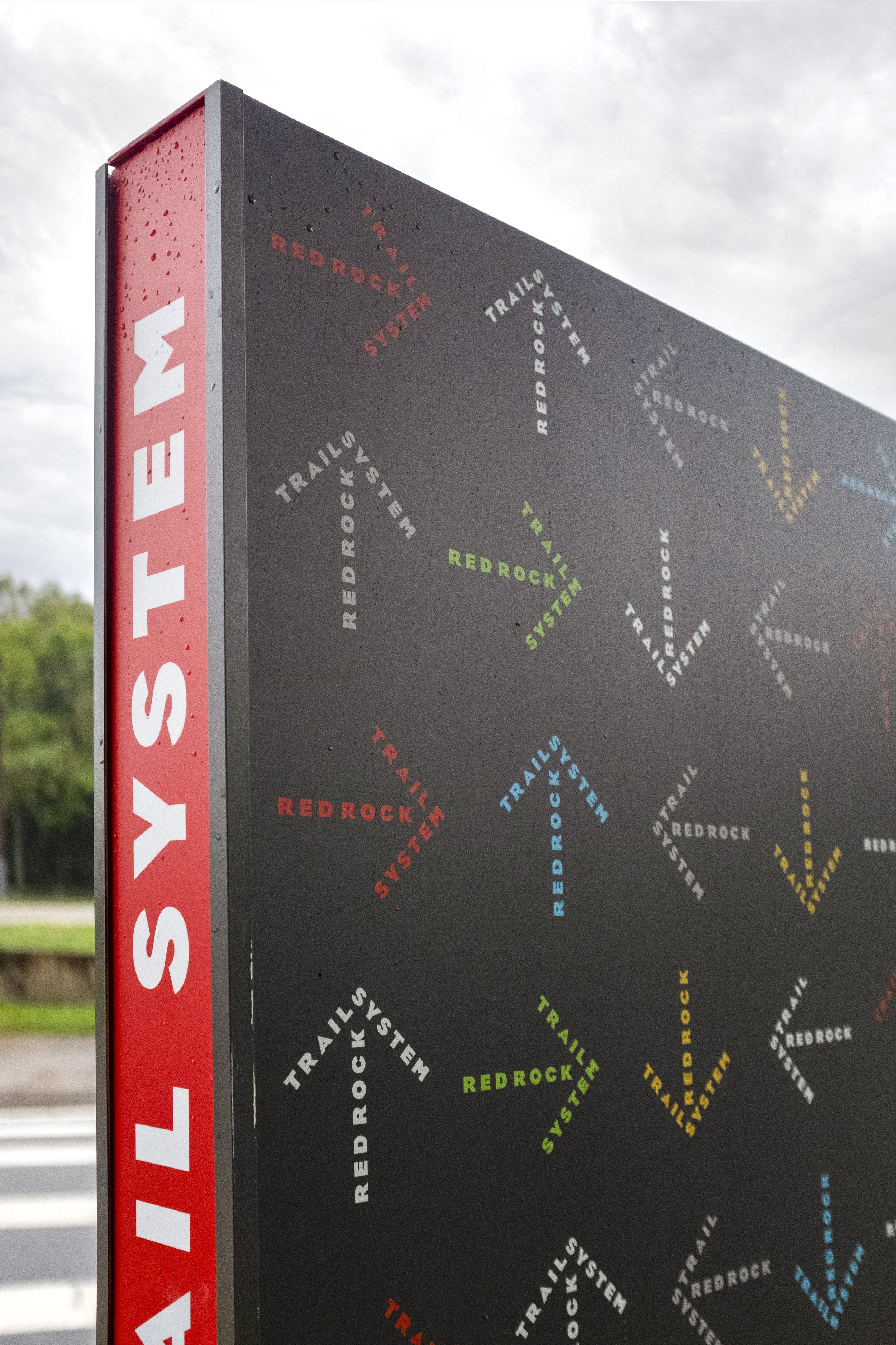
It was discovered through the design process that the when the RRTS name was composed in the diamond lockup it could also be dissembled to form four unique typographic arrows. These become a supporting graphic device that is able to be used individually or combined to create a brand pattern.


Defining a key audience for a large-scale public amenity is challenging. The reality is that anybody regardless of age, ability, or preferred activity is welcomed on the RRTS. The diversity of the audience is the brand’s strength and in promotional campaigns they become the hero of the RRTS.

There are seven trail corridors across Jefferson County. Previous community input sessions with the FLT staff had already established unique visual symbols to represent each corridor. These were paired with a specific color to create sub-identities for each corridor. Each one is encased in the RRTS typographic diamond so that the corridors retain their individuality but are clearly connected to the larger trail system.

Custom icons were developed for the trail maps and implemented to locate specific amenities on the trails, and to indicate rules and regulations.

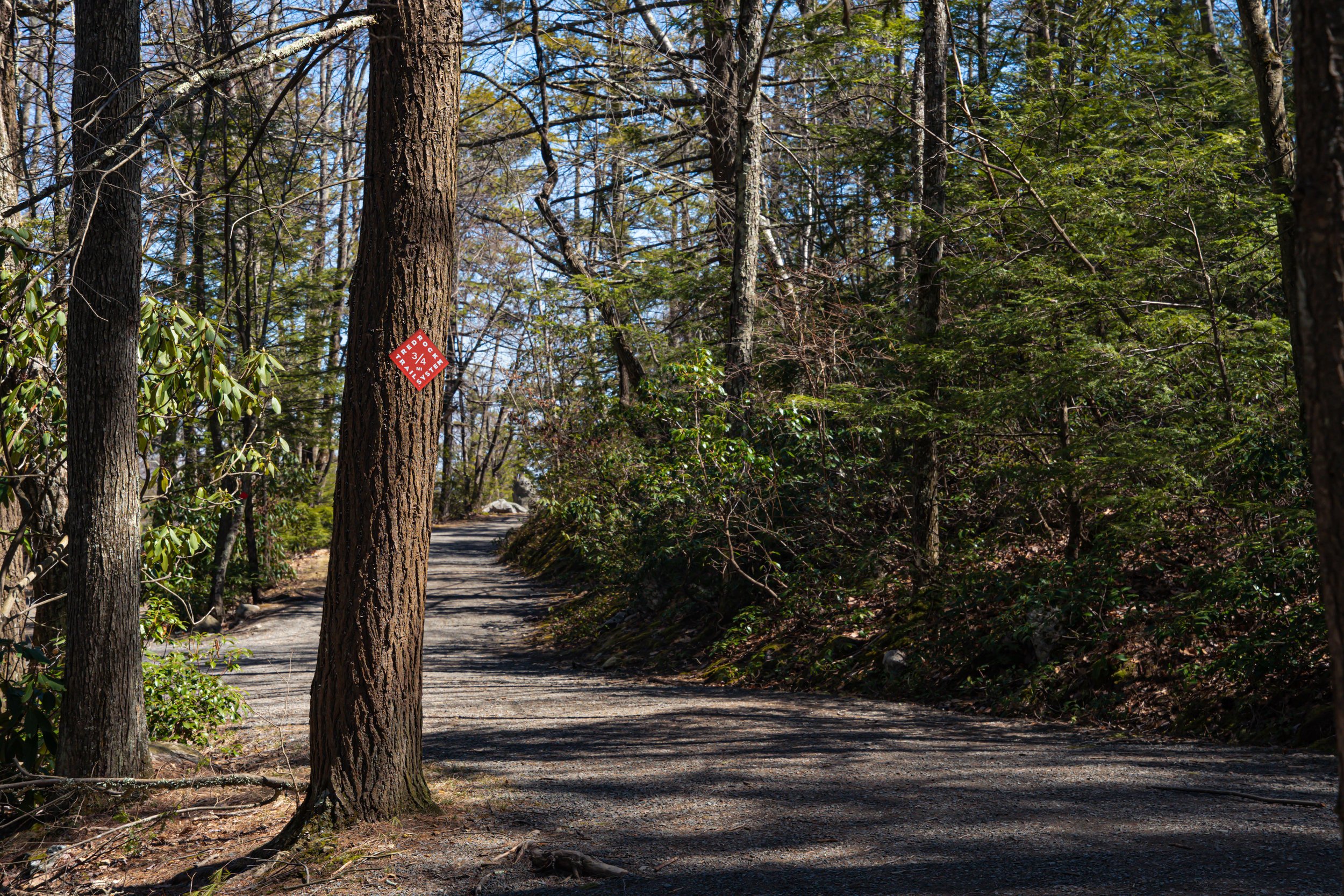
Four main sign formats were created: Oversized Map Kiosks installed at the trailhead of major trails, Small Trail Signs for shorter trails, Interpretive Waysides for special natural or historical information, and Trail Blazes for simple trail identification and distant demarcation.

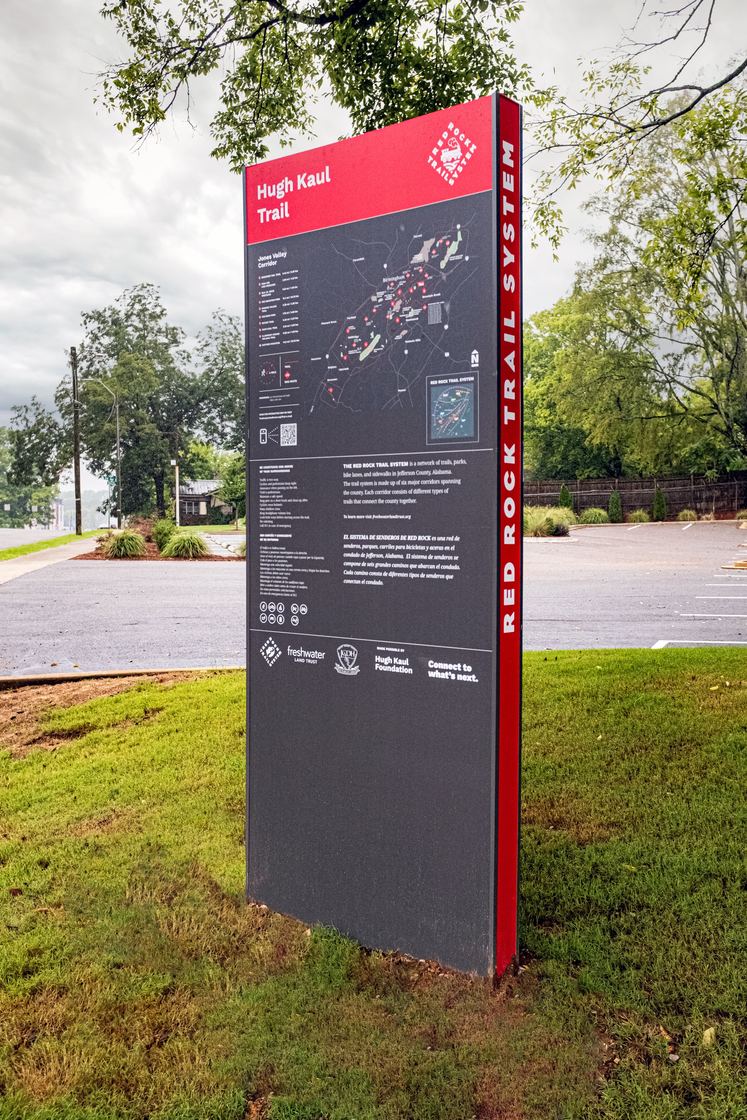
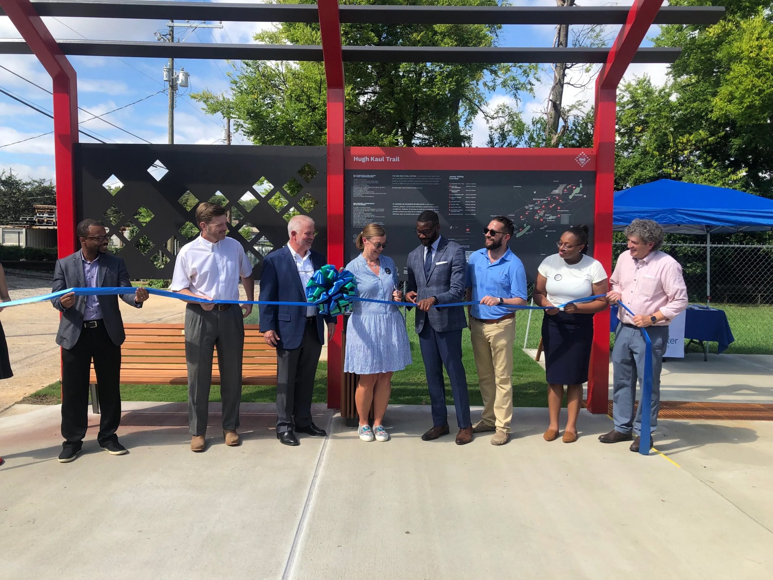
A comprehensive identity and signage guidelines document was delivered at the completion of the project to educate and empower FLT staff to implement the design system on a rolling basis as grant funding or donor support is awarded.

Selected Press
Auburn professor wins national awards for new Red Rock Trail System signs, Bham Now. Emma Johnston.
Graphic Design Program Chair Wins GDUSA Award
“Robert did a great job with really understanding the different families of trails,” Hernandez stated. “He designed a branding system that lets each of them shine individually while still being instantly recognizable as part of the greater Red Rock Trail System.”